Many of you may be familiar with the Johnson County AIMS site, but it you’re not, we thought we would give you a quick introduction to one of the tools that we use when collecting information about properties in Johnson County. The AIMS site stands for Automated Information Mapping System and it can provide you with county-wide, up-to-date, digital data.
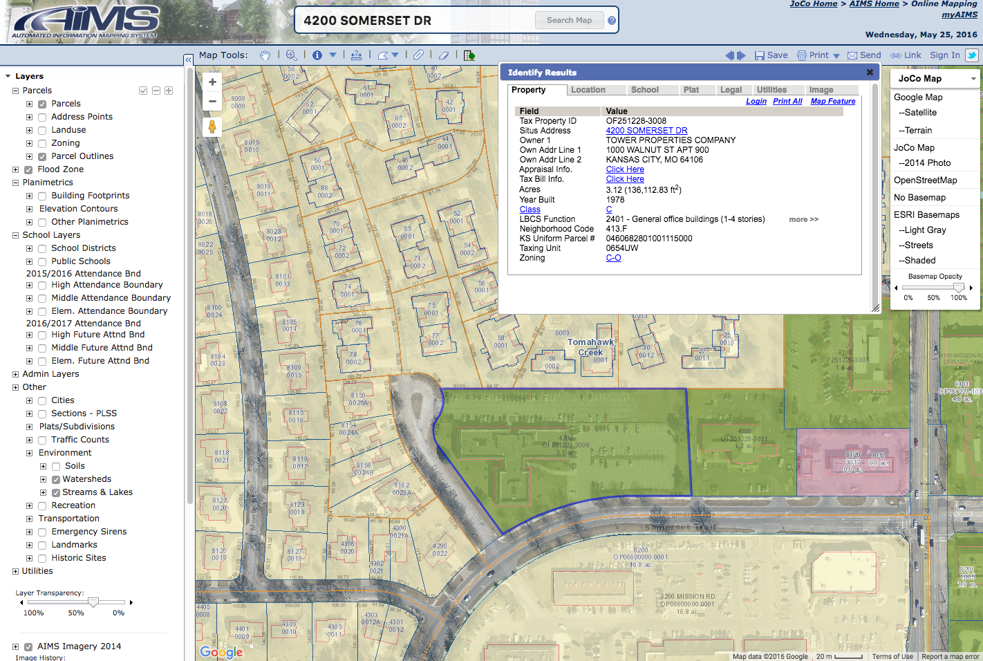
Some of the advanced features on AIMS cost extra, but the basic, free tools can be very helpful. All you have to do is visit: http://aims.jocogov.org/. Once you’re on the site, on the left, under products and services, click JoCo Online Mapping. You can then search an address at the top of the screen and use the layers on the left to find information about utility lines, property boundaries, land use, school layers, flood plains and more.
On the right you’ll be able to see the nearest emergency locations, your local commissioner district, schools, available utilities and my personal favorite – historical photos of the property in case you’d like to take a walk down memory lane of what your house used to look like years ago. You can also go back in time using the slider under AIMS imagery on the left showing aerial views of the county back into the 40s.
Of course, if you’re ever looking for specific neighborhood information, please don’t ever hesitate to call us!